Radhanath Sikdar didn't discover Everest. He did something harder
Bengal believes he measured the highest mountain on earth. The Survey of India's own records show what he did, what he did not do, and how a legend came to carry his name.
Achintyarup Ray ·
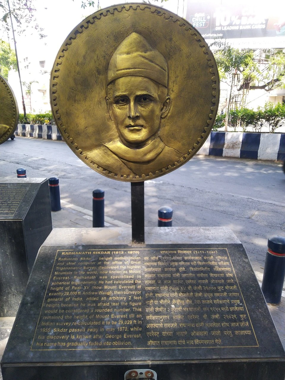
Ask almost anyone in Bengal who measured Mount Everest, and the answer comes at once: Radhanath Sikdar. It is in our textbooks, on a memorial in Pune and all over the internet. The records of the Survey of India tell a different story.
Sikdar did not discover Everest, and he did not measure it. He never saw the mountain. The angles were taken by a surveyor named James Nicolson, from the plains of Bihar, in the winter of 1849–50. The first heights were worked out in the Survey’s office at Dehra Dun, while Sikdar was posted in Calcutta. He did not rush into his boss’s room shouting that he had found the highest mountain in the world; that scene first appears in print long after his death. And the famous tale that he got exactly 29,000 feet, and the British added two feet, is false: the Survey’s own six readings average 29,002.
But that is only half the story. Sikdar was the Survey’s finest mathematician. For six years, his chief kept writing to him about the hardest part of the job: correcting for the curve of the earth and the bending of light in the air, so that a mountain measured from more than a hundred miles away could be trusted. He was not the discoverer. He was the man the Survey turned to when the number had to be right.
This piece sets out, document by document, what happened, how we know it, and how the legend grew.
An evening on Park Street
On the evening of 6 August 1856, the Asiatic Society of Bengal held its monthly general meeting at its house on Park Street. For most of its length it was an ordinary evening. Three new members were balloted in. A committee read out a long and withering report on a geological map of India sent from London, which had placed coal where there was none and ranges of hills a hundred miles from where they stood. A despatch from the Court of Directors complained that the Society was spending too much of the Company’s money printing Arabic theology. A Captain Hay wrote from Kangra about Bactrian coins.
Near the end, Major Henry Thuillier, the Deputy Surveyor-General, begged permission to make an announcement that had not gone through the Council in the usual way. On behalf of his chief, Colonel Andrew Scott Waugh, he told the meeting that the Great Trigonometrical Survey had found a mountain higher than any yet measured. Its survey number was XV. It stood in latitude 27° 59′ 16.7″ N and longitude 86° 58′ 5.9″ E, 29,002 feet above the sea and 846 feet higher than Kangchenjunga. Waugh, Thuillier said, proposed to call it “Mont Everest”, after his predecessor.1
Two pages earlier in the same printed minutes, under “Communications were received”, there is another entry: “From Babu Radhanath Sikdar forwarding copy of a Meteorological Register kept at the Surveyor General’s Office, Calcutta, for the month of May last.”
That is the only appearance of Radhanath Sikdar in the record of the evening on which the height of Everest was given to the world. He is there as the man who sent in the weather.
The legend
The story most people know runs differently. One day in 1852, it goes, a young Bengali mathematician burst into Waugh’s office and announced: “Sir, I have discovered the highest mountain in the world.” Sometimes a coda is added. Sikdar’s calculation came out at exactly 29,000 feet, and Waugh, afraid that so round a number would be taken for an estimate, quietly added two feet.
The story is in school textbooks, newspaper features and on Wikipedia, where the two-feet coda carries a “citation needed” tag. India Post has put Sikdar on a stamp. In 2015 a paper in the Indian Journal of History of Science told the office scene as fact and suggested that the peak should also be known as “Mt Sikdar”.2
The question for this piece is a narrow one. Did Radhanath Sikdar measure the height of Everest?
The short answer is no, not in the way the legend says. Nobody measured Everest alone. But the answer the records do support is not the one his detractors give either, and the gap between the two says a good deal about who gets written into the history of colonial science and who is written out.
The man
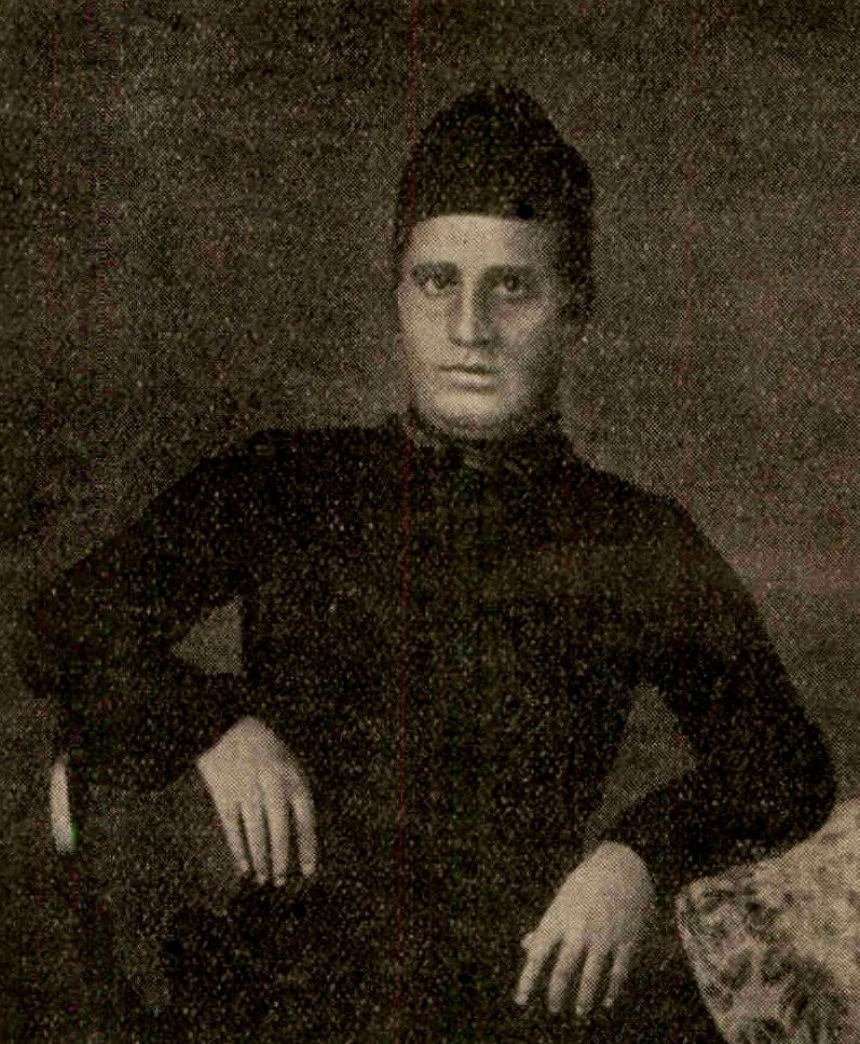
Radhanath Sikdar was born in Calcutta in 1813 and educated at the Hindu College, where he was one of the young men who came under the spell of Henry Derozio. In 1831 he joined the Great Trigonometrical Survey as a “computer”. In the nineteenth century that was a job title, not a machine: a computer was a person who reduced field observations to numbers by hand, with logarithm tables and long columns of arithmetic.
George Everest, then Surveyor-General, took to him at once. He wrote that Sikdar was a hardy young man ready to undergo any fatigue, that there were few instruments he could not manage and none of the calculations he had not mastered. “He can not only apply formulae but investigate them,” Everest wrote, and called him the ablest pupil the Hindu College had produced.
Sikdar worked in the field on the Great Arc and in the computing office at Dehra Dun. In 1849 he became Chief Computer at the Survey’s head office in Calcutta, and later also superintendent of the meteorological observations kept there. He wrote the more technical chapters of the Survey’s Manual of Surveying for India. He retired in 1862 and died in 1870. By any measure he was the most accomplished Indian mathematician in the Survey’s service in his generation, and that is not in dispute. What is in dispute is one number.
What happened in the field
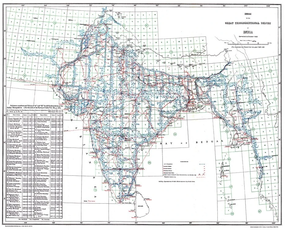
The mountain was observed from Bihar by James Nicolson between 27 November 1849 and 17 January 1850. Nepal was closed to the Survey, so its officers could only look at the Himalaya from the plains, from masonry towers and scaffolding along the line of triangles called the North-East Longitudinal Series. In 1847 Waugh himself, at Darjeeling, had noted a distant peak he labelled gamma; John Armstrong, observing from near Muzaffarpur, had called what was probably the same summit “b”. Nicolson, with a 24-inch theodolite, took the angles that mattered.
In 1904 the Surveyor-General, Sidney Burrard, published the figures in Nature, “extracted from the Records of the Great Trigonometrical Survey of India”:3
| Station | Date of observation | Distance from the peak (miles) | Height computed (feet) |
|---|---|---|---|
| Jirol | 27 Nov 1849 | 118.661 | 28,991.6 |
| Mirzapur | 5–6 Dec 1849 | 108.876 | 29,005.3 |
| Janjpati | 8–9 Dec 1849 | 108.362 | 29,001.8 |
| Ladnia | 12 Dec 1849 | 108.861 | 28,998.6 |
| Harpur | 17–18 Dec 1849 | 111.523 | 29,026.1 |
| Minai | 17 Jan 1850 | 113.761 | 28,990.4 |
| Mean | 29,002.3 |
The stations stood between 219 and 255 feet above the sea. Every one of them was more than a hundred miles from the summit. At that distance the curve of the earth and the bending of light through the air mattered as much as the angle itself.
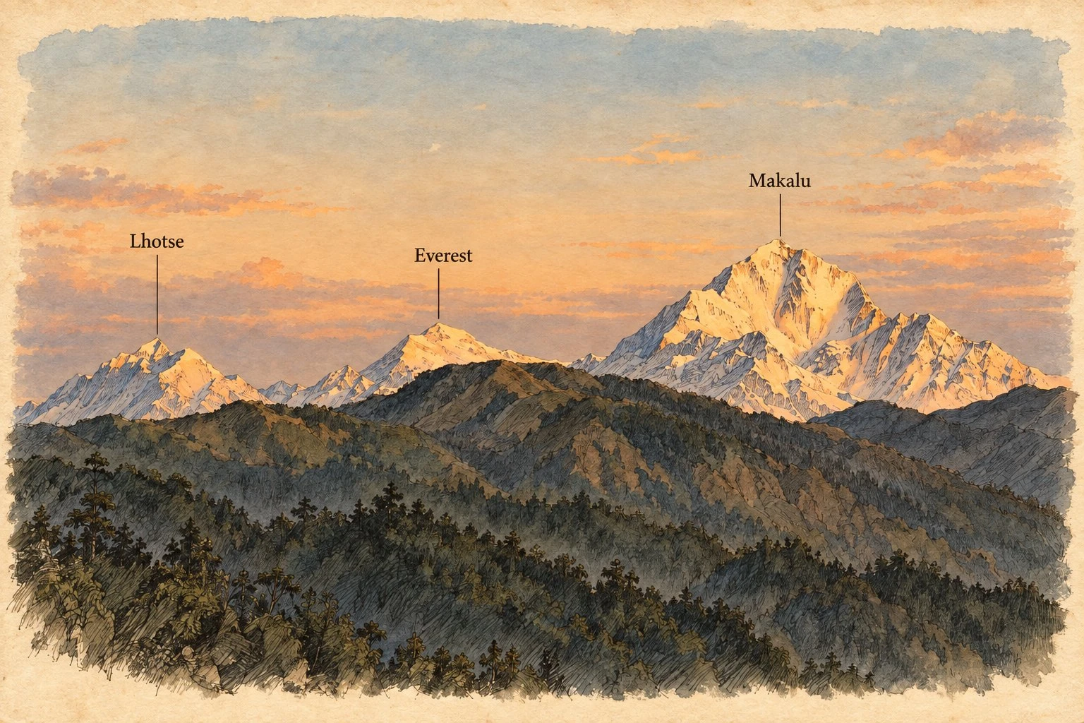
Nobody in the field knew what they were looking at. Burrard wrote that “on no occasion had the observer suspected that he was viewing through his telescope the highest point of the earth”. General James Tennant, who sat on one of Waugh’s committees, recalled thirty years later that Waugh used to dwell on exactly this point: the mountain “was a rounded top, nowhere conspicuous, and by no one suspected of being exceptionally high”.4 From the plains of Bihar, the nearer Makalu looks taller.
Discovery happens on paper
If no observer saw it, Everest was found by computation. That much both sides of the argument accept, and the Survey’s own descriptions of its method make it plain.
Waugh’s standing order, Burrard explained, was that every visible peak should be observed from every station, but that the identification of peaks “must be left to computers”. The office then worked in four steps. The stations were plotted on a map and a line drawn from each towards every peak seen from it. Where lines from three or more stations met at a point, it was provisionally assumed to be one peak. Its distance from each station was computed by trigonometry, and if the positions agreed, the identification stood. Finally, a height was worked out from each station’s vertical angle; if the heights agreed too, the peak was accepted.
Tennant put the same process in a sentence: “Rays from a large number of stations were found to pass through one point and, on computing the triangles, to belong to one summit, and afterwards the observations of elevation were found to agree in giving the same height.” General James Walker, Surveyor-General from 1878, drew the conclusion in 1886: the discovery “was not a revelation at first sight, but the result of slow and carefully elaborated processes of induction”.4
Walker also gives a date that the legend does not survive easily. The observations of November 1849 to January 1850, he wrote, “were not reduced rigorously until the following summer recess. The results were not published until 1854.” The summer recess was when field parties came in from the heat and the rains and worked up their season’s observations. On Walker’s account, the rigorous reduction that showed Peak XV standing above everything else was done in 1850, by the Survey’s computers, two years before the famous scene in 1852.
Where was Sikdar?
He was in Calcutta, more than eight hundred miles from Waugh. The Survey ran a split establishment: the field headquarters and the Surveyor-General sat at Dehra Dun, while the head office, with its computing and drawing staff, remained in Calcutta. Sikdar left Dehra Dun for Calcutta in January 1849, before Nicolson took a single angle at Peak XV.
A letter he wrote to Waugh on 6 June 1852, found in the National Archives in New Delhi by the historian Ashish Lahiri, shows how far he was from the work on the snow peaks:5
May I request the favor of your instructions as to whether Darjeeling Triangulation should be introduced into the Calcutta Series Report. I think that the operation would most appropriately be brought into the N. E. Longl Series Report, and perhaps this has been already done at your Head Quarters. I am necessitated to make this reference because in 1849 when I left Dehra Dun, if I remember right, it was your intention that the Darjeeling work should appear in the Calcutta Series Report, and I have been favoured with no intimations of your having ordered a different arrangement.
Lahiri reads this as a sign that Waugh had shut Sikdar out of the North-East Longitudinal work and that Sikdar resented it. Read plainly, it says something simpler. In the middle of 1852, the year in which he is supposed to have rushed in with the world’s highest mountain, the Chief Computer did not know whether headquarters had already dealt with the very series from which the mountain was observed.
Everest’s biographer J. R. Smith found the same gap from the other side. Sikdar’s report of 1856 made no reference to the North-East Longitudinal Series at all; that series was dealt with at Dehra Dun by John Hennessey, and Waugh acknowledged as much when he wrote about the snow-peak computations.6 The astrophysicist and historian Rajesh Kochhar cites a Survey progress report to the same effect: after Sikdar went to Calcutta, a small computing office of Indian surveyors and new sub-assistants was set up at Dehra Dun under Hennessey, and it was there that the snow peaks, Everest among them, were computed.7
The case for Sikdar
That is not the end of it, because the computations did not stop in 1850. Heights measured from more than a hundred miles away depend on assumptions: how much the air bends the line of sight, what shape the earth is taken to have, and where exactly sea level lies beneath stations in the middle of Bihar. Those assumptions were the Chief Computer’s business, and the record shows Waugh bringing them to Sikdar for six years.
In December 1850, according to Smith, Waugh asked Sikdar to revise the form of computing the positions of snow peaks more than a hundred miles distant. For the next few years the two discussed refraction coefficients and the datum for heights, which had to wait until Tennant finished tidal observations at Karachi at the end of 1855. That wait is one reason the announcement came only in 1856.
Lahiri’s tables of the Calcutta correspondence fill in the rest. In January 1855 Hennessey himself consulted Sikdar on the Darjeeling Series angles. In May 1855 Waugh asked him to search the records in his charge for any angle books containing observations to the Himalaya. On 18 July 1856, four months after Waugh had proposed the name, he asked Sikdar’s opinion on the correction needed to reduce the heights of distant mountains to the ellipsoid. Thuillier’s announcement three weeks later said the revision of the computations had proceeded “to some extent”. And on 25 August 1856 Waugh wrote to Calcutta: “I am glad that the name I have given to the highest snowy peak has given satisfaction to yourself as well as other superior members of the Department.”5
The historian John Keay concluded that it was “quite probable” Sikdar’s computations gave the first clear proof of Peak XV’s superiority.8 Lahiri goes further and calls Sikdar the “pivot” of the computations, though he admits that he has never seen any paper of Sikdar’s relating to the calculation itself.
Weighed fairly, the letters show something real. Sikdar was the Survey’s authority on method, consulted on exactly the refinements that turned a provisional 1850 figure into the one Waugh was willing to publish. The August 1856 letter shows he was told about the name, as one of the “superior members of the Department”. That is a statement about his standing, not about who did the sum. None of the letters Lahiri tabulates is an announcement from Calcutta that a peak had been found to be the highest in the world.
The arithmetic of a myth
The two-feet story can be checked with nothing more than the table above. Add the six station heights and divide by six, and the answer is 29,002.3 feet. No station gives 29,000. The mean is not a round number that someone padded; it is simply what the six observations average to.
For the story to be true, somebody would have had to compute a different figure of exactly 29,000 feet, by a method that appears in no record, and Waugh would then have had to adjust it to a value that happened to match the Survey’s own mean to the foot. The Survey published the six heights and their mean in 1904. The Survey of India’s geodesist B. L. Gulatee printed them again in the Himalayan Journal in 1952.9 The tale has gone on being repeated by people who have not done the division.
How the legend was built
The office scene can be traced, link by link, and every link is thinner than the one it rests on.
The first is Burrard’s article of November 1904, written to settle a quarrel about the mountain’s name, not its discoverer. In one sentence he says: “About 1852 the chief computer of the office at Calcutta informed Sir Andrew Waugh that a peak designated XV had been found to be higher than any other hitherto measured in the world.”3 He gives no name and no source, and he is writing half a century after the event. The chief computer at Calcutta in 1852 could only have been Sikdar. But “informed” need mean no more than a letter, there is nothing about bursting into a room, and the sentence sits awkwardly beside Walker’s account of a rigorous reduction in 1850.
The second link, as Kochhar traced it, is a speech Kenneth Mason of the Survey gave at Simla in 1928. The Englishman of 12 November 1928 reported him describing a babu rushing into Waugh’s room with the news. The third is Jogesh Chandra Bagal, who quoted that report in The Modern Review in 1933 under a title that called Sikdar the discoverer of Mount Everest.7 Kochhar admits he never saw the full newspaper report; nor, as far as I know, has anyone since. Gulatee noted in 1952 that Burrard himself, in a later book, argued that the famous words could not have been uttered.9
From there the story entered textbooks and, eventually, the internet. The 2015 journal paper that proposed “Mt Sikdar” sources the office scene to a web article on geodesy. For the claim that Sikdar was lost in the pages of history, it cites the volume of Phillimore’s Historical Records of the Survey of India covering 1815 to 1830, two decades before Peak XV was observed.2
The sceptics have their own shortcuts. Reginald Phillimore, the Survey’s official historian, held that Sikdar had no share in the discovery. Matthew Edney’s standard history, Mapping an Empire (1997), dismisses him as a “Calcutta Brahmin” wrongly credited with the height. Kochhar, writing in 2021, says the published records show Sikdar had no role in calculating the Himalayan heights. Lahiri’s letters make that last claim hard to hold.
What the records say, and what they leave out
Put together, the records support a plain verdict. James Nicolson took the angles in the winter of 1849–50. The computing office at Dehra Dun under John Hennessey reduced them, and on Walker’s account the rigorous reduction was done in the summer of 1850. Radhanath Sikdar, in Calcutta, revised the method for distant peaks and was consulted on refraction, the datum and the shape of the earth until the figure was published. Waugh announced it, named it and took the credit, as Surveyors-General did. The single sentence placing a Calcutta chief computer at the moment of discovery was written fifty years later, without a source.
So Sikdar did not measure Everest, and he did not discover it. But the honest version of his part is not a consolation prize. In a service that rarely let an Indian sign his name to anything, the Surveyor-General kept writing to a Bengali in Calcutta about ellipsoids, and kept wanting his opinion.
The silences in the record are the more interesting part. The Survey’s documents name its officers and almost never its computers. The Indian surveyors and sub-assistants who did the arithmetic at Dehra Dun are nameless in every account I have read. Sikdar’s legend may have absorbed their work as well as his own, simply because he was the one Indian computer whose name anyone remembered.
Names were contested in other ways that year too. At the Society’s next meeting, in September 1856, the Council proposed that the peak be called after Waugh rather than Everest; the members voted it down. In October Brian Hodgson wrote to the Society that the mountain already had a local name, Deva-dhunga, which Waugh’s committee rejected. Tibetans on the far side, as Laurence Waddell reported in 1898, called the range by names of their own.10 None of that made it onto the map either.
And Sikdar’s own part was trimmed after his death. The preface to the Manual of Surveying for India had credited him with its more technical chapters. When that acknowledgement was dropped from a later edition, a former Deputy Surveyor-General, John Macdonald, protested in The Friend of India in 1876.
Which brings us back to Park Street. Month after month in 1856, the Society’s Proceedings record the same small entry. In August: from Babu Radhanath Sikdar, the meteorological register for May. In September: the registers for June and July. In October: the register for August. The man Waugh consulted about the height of the highest mountain on earth appears in the minutes, faithfully and without fail, as the man who sent in the weather.
Footnotes
-
“Proceedings of the Asiatic Society of Bengal for August, 1856”, Journal of the Asiatic Society of Bengal 25 (1856), pp. 419–472. Also the Proceedings for September and October 1856 in the same volume. ↩
-
“Trigonometrical Survey of India and Naming of Peak XV as Mt Everest”, Indian Journal of History of Science 50.4 (2015). ↩ ↩2
-
S. G. Burrard, “Mount Everest: The Story of a Long Controversy”, Nature 71 (10 November 1904), pp. 42–46. See also Douglas W. Freshfield’s reply, Nature 71 (24 November 1904). ↩ ↩2
-
J. T. Walker, “A Last Note on Mont Everest”, Proceedings of the Royal Geographical Society (April 1886), including General J. F. Tennant’s recollections. ↩ ↩2
-
Ashish Lahiri, “Radhanath Sikdar and the Final Phase of Measuring Peak XV”, Indian Journal of History of Science 51.2 (2016), pp. 280–288. ↩ ↩2
-
J. R. Smith, Everest: The Man and the Mountain (Whittles, 1999), p. 191. ↩
-
Rajesh Kochhar, “Did Radhanath Sikdar Measure the Height of Mount Everest First?”, The Wire Science, 8 October 2021. ↩ ↩2
-
John Keay, The Great Arc (HarperCollins, 2000). ↩
-
B. L. Gulatee, “Mount Everest: Its Name and Height”, Himalayan Journal 17 (1952). ↩ ↩2
-
L. A. Waddell, “The Environs and Native Names of Mount Everest”, Geographical Journal (December 1898). ↩